October, 2012. I found about Fiery Gizzard Trail by searching for great hikes in Tennessee online. For a trail that is not part of a national park unit, it’s quite popular and has a lot of praise from hikers and backpackers. Fiery Gizzard is 12.5 to 13 miles one way (depending on where you read), and while the endpoints are in the state park system, the middle runs through private land, and the owners are gracious enough to allow hikers on their property. This trail is currently (2016) in danger because the land is being sold. The trail may be rerouted. Fiery Gizzard is not excessively difficult, but does have two places with a fairly long uphill slope and some uneven footing in parts. The sheer length is significant too!
I began my outdoor fascination by caving, but there are only so many places you can do that... and no caving club anywhere I've ever lived. Sure, Tennessee has loads of caves, but they are in the east and I lived in Memphis in the west. On the way back from Raccoon Mountain Caverns (Chattanooga), I went by the interstate exit near Fiery Gizzard and hiked the first half-mile or so, a lovely path through an emerald forest by a flowing creek. On fall break from graduate school, I headed out there to try the whole thing. The trail runs from Grundy Forest south by southeast to the other trailhead at Foster Falls. This trip, I planned to hike from the Grundy Forest end to a point 6.6 miles into the trail, an old moonshine still which marks the approximate halfway point. Then, the following day I would hike from the Foster Falls end to the still and back. (By myself, I couldn't go from one end to the other without turning all the way around!)
The Grundy Forest trailhead greets you with this detailed sign:
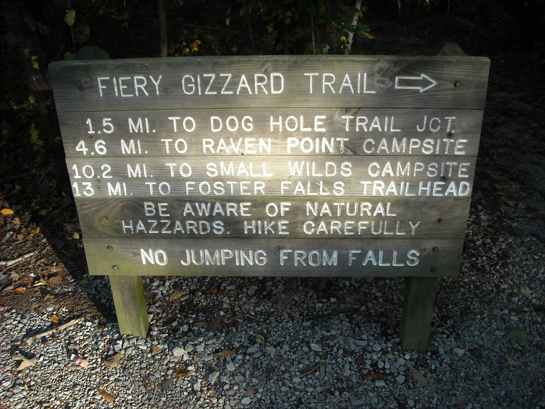
Wait, "hazzards"? "Gizzard" has two Zs, but the word is "hazards" with one Z unless you're talking about the Dukes of Hazzard.
Where does the bizarre name of this trail come from? Well, from Fiery Gizzard Creek which flows through Fiery Gizzard Gorge, but where did those come from? One story is that Davy Crockett was eating a turkey or chicken gizzard and angrily spat it into the gorge, perhaps because it was too hot. The more reasonable story is on a historical marker in nearby Tracy City, and says the the Fiery Gizzard was an experimental blast furnace built in the area. It only worked for a few days, then collapsed. So it was not a successful experiment.
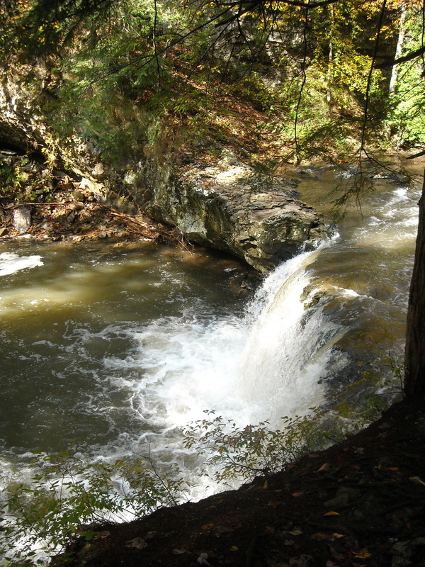
This first leg of the trail starts descends down to Fiery Gizzard Creek, and winds along the banks for several miles. Along the way are plenty of waterfalls, pools, rocky overhangs, and a lovely dense mossy forest.
Where does the bizarre name of this trail come from? Well, from Fiery Gizzard Creek which flows through Fiery Gizzard Gorge, but where did those come from? One story is that Davy Crockett was eating a turkey or chicken gizzard and angrily spat it into the gorge, perhaps because it was too hot. The more reasonable story is on a historical marker in nearby Tracy City, and says the the Fiery Gizzard was an experimental blast furnace built in the area. It only worked for a few days, then collapsed. So it was not a successful experiment.
This first leg of the trail starts descends down to Fiery Gizzard Creek, and winds along the banks for several miles. Along the way are plenty of waterfalls, pools, rocky overhangs, and a lovely dense mossy forest.
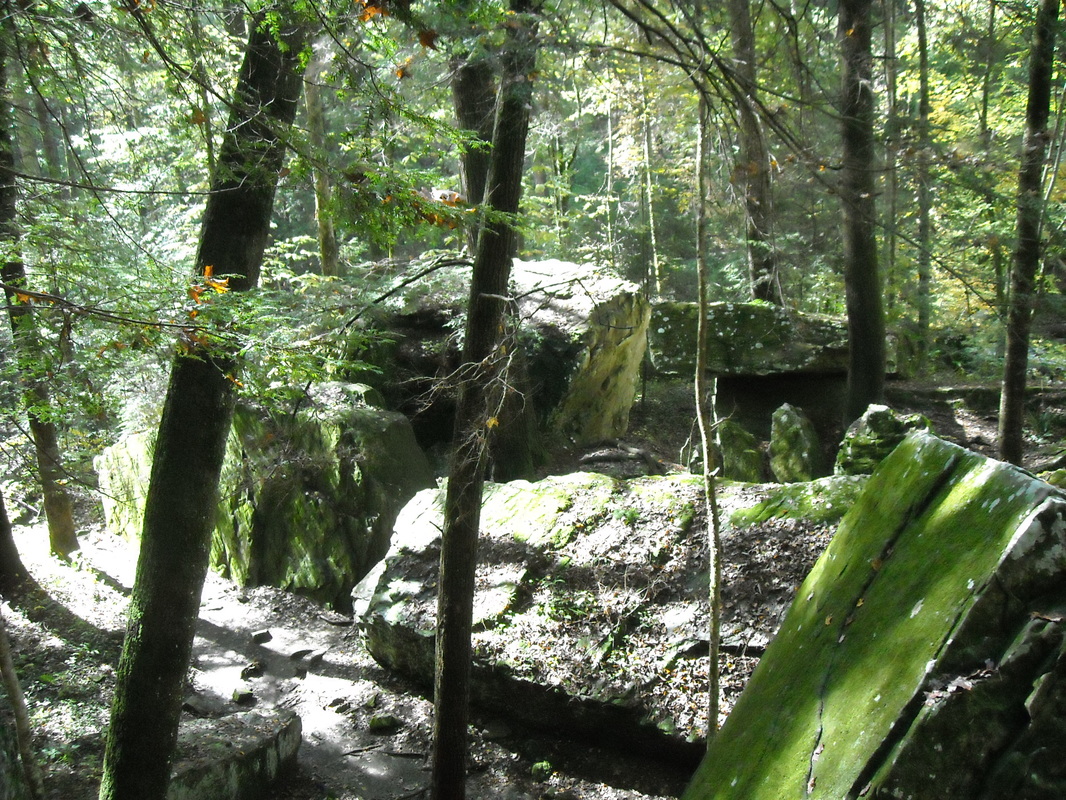
This part of the trail passes through the Fruit Bowl, a jumble of boulders that must have fallen from above at some point. The boulders are mossy and slippery - watch out!
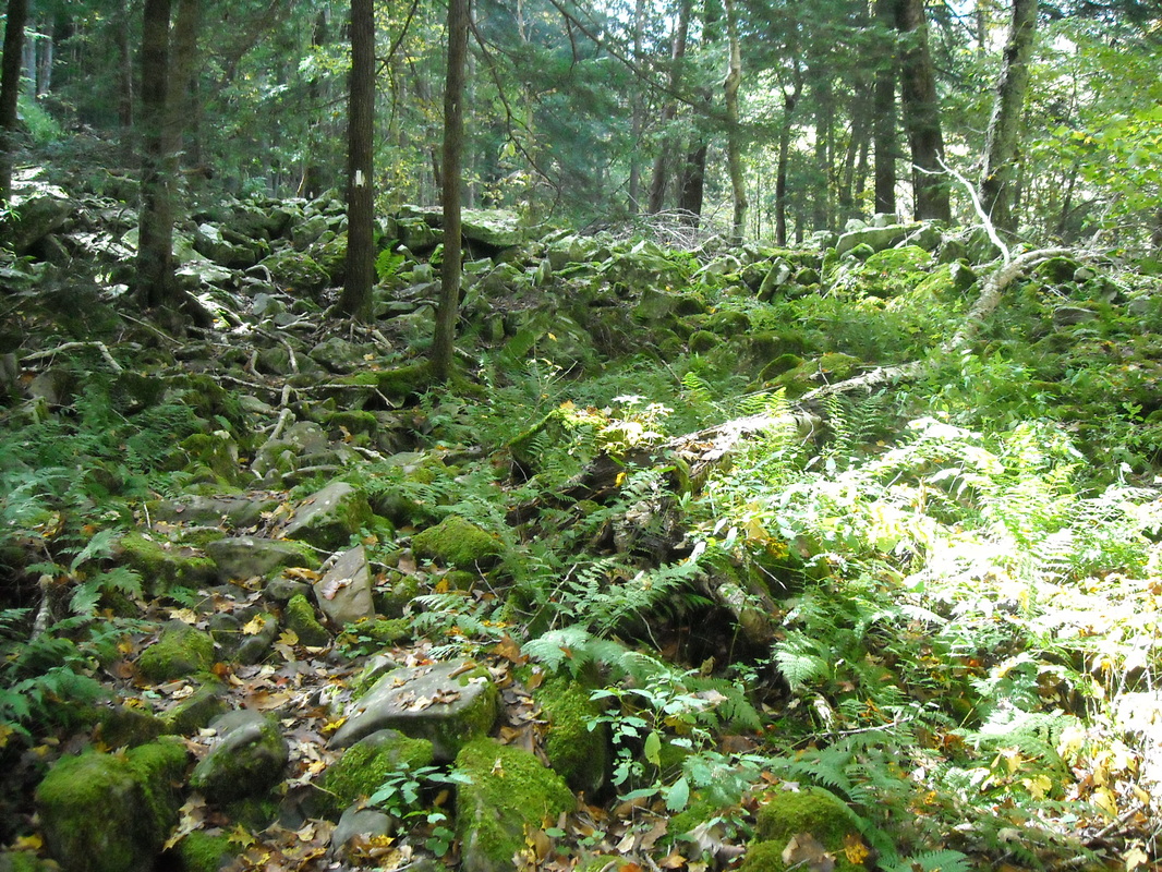
This section of Fiery Gizzard is lush and green, like something out of a fantasy novel.
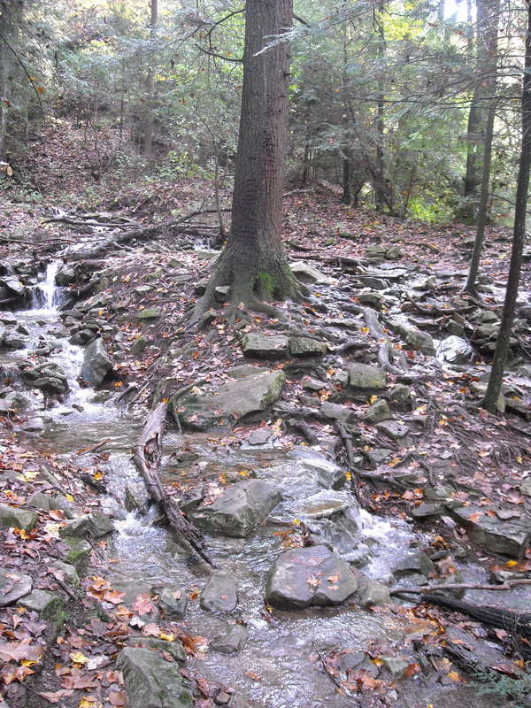
Here, the trail runs by a tree surrounded by clear running water. Very serene.
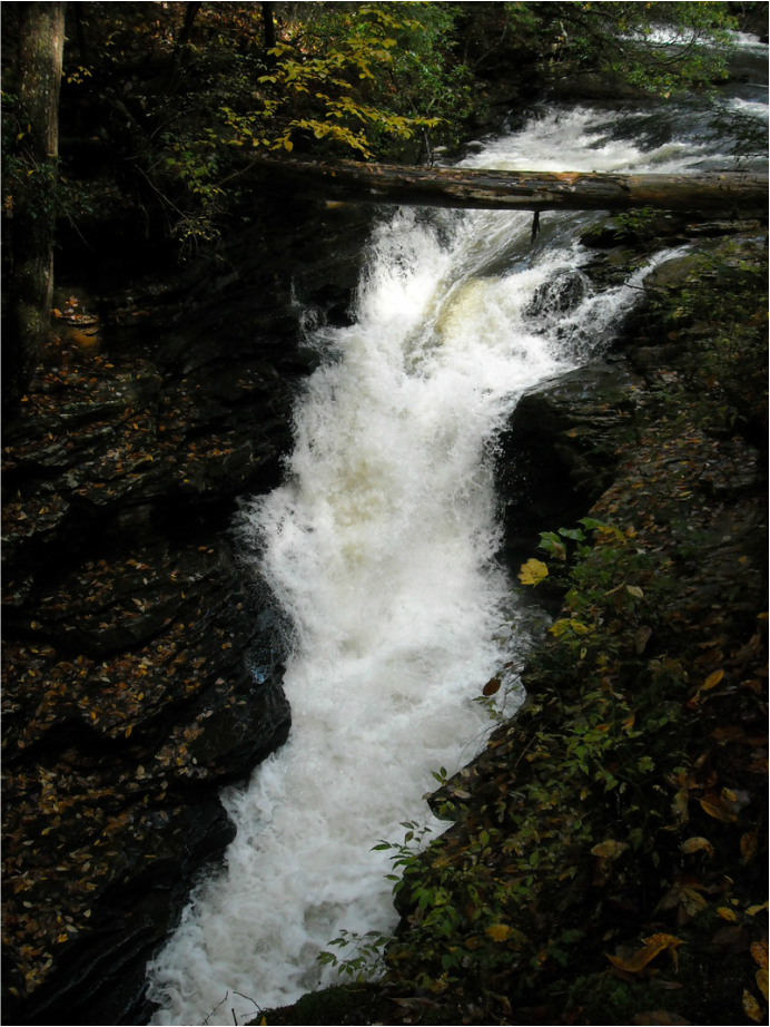
There are quite a few waterfalls along the creek, and this is one of the more violent ones:
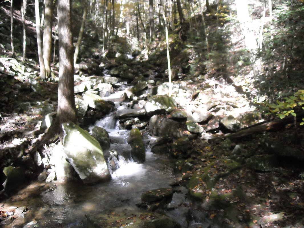
The creek part of this trail is quietly idyllic, full of the sound of running water. Stray rays of sunlight manage to penetrate the canopy and glint off the moss that covers rocks and trees. Here is mini-waterfall tumbles down form high above the trail:
After a mile and a half, I passed the junction with Dog Hole Trail. This trail simply bypasses some of Fiery Gizzard, then rejoins the main trail after about 3 miles. Dog Hole is actually slightly shorter than the section of Fiery Gizzard it skips, and I'd be taking it on the way back. Beyond the Dog Hole junction, there is a cliff wall with various pits and caves in it. One cave, according to online sources, has a small spring in it. I investigated, and, sure enough:
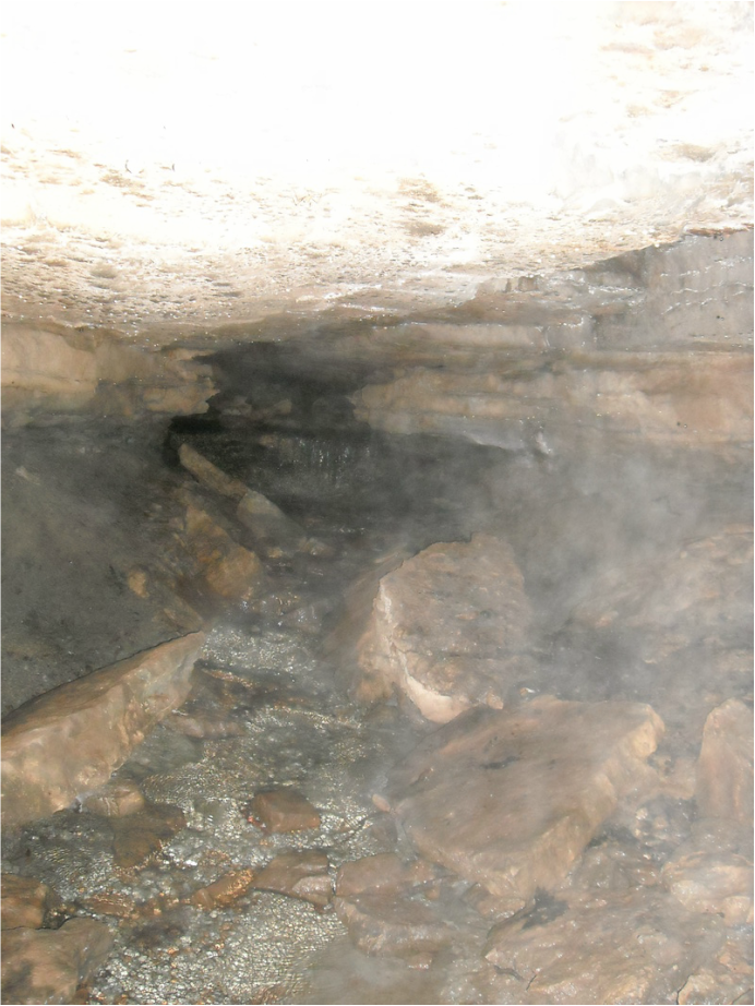
It's hard to see with all the humidity gumming up the picture, but this is a small cave with a gently bubbling spring in the back, and the water running out in a stream. I wonder if the water is drinkable? I didn't risk it.
Fiery Gizzard then ascends a long, steep hill to leave the creek bed and arrive on top of the gorge. A side trail - highly recommended! - heads a half-mile off the main trail to visit Raven Point, a stunning overlook:
Fiery Gizzard then ascends a long, steep hill to leave the creek bed and arrive on top of the gorge. A side trail - highly recommended! - heads a half-mile off the main trail to visit Raven Point, a stunning overlook:
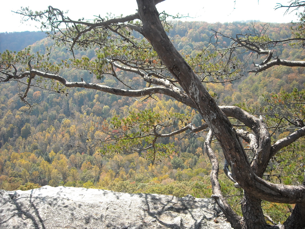
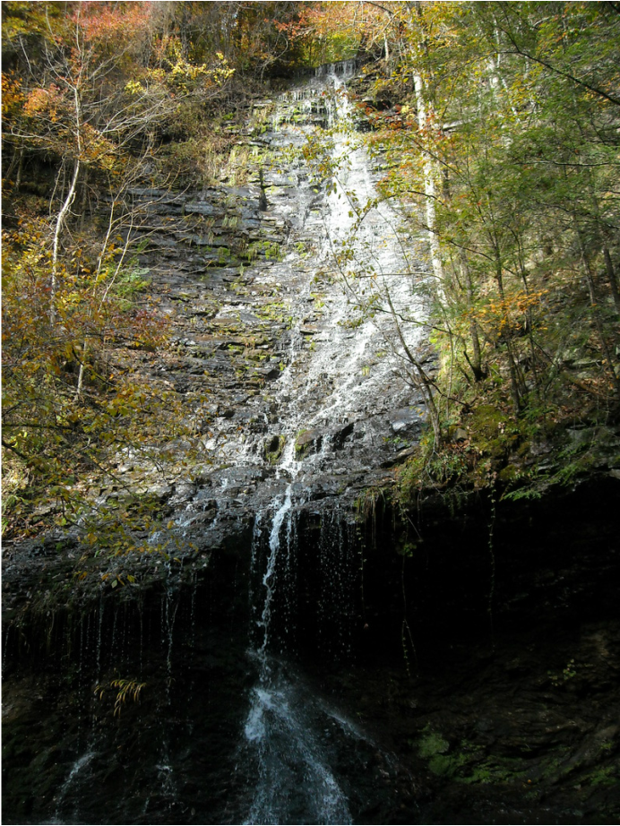
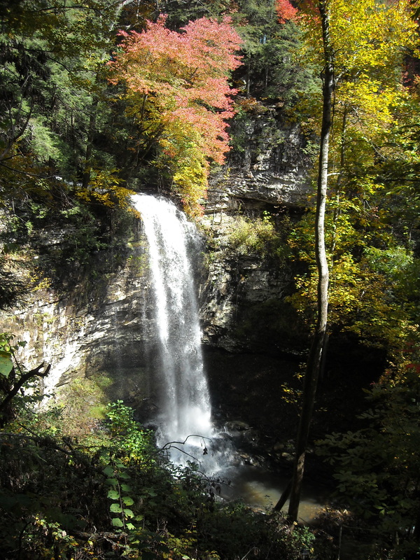
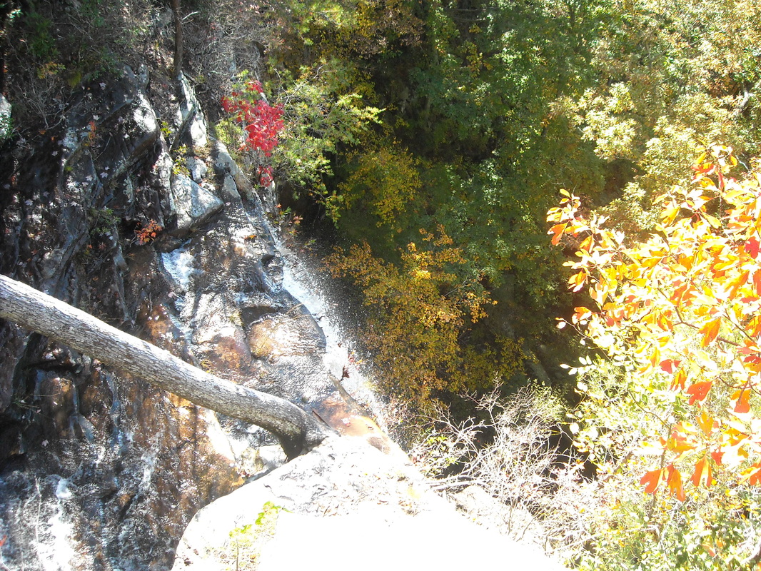
Returning from the side trip to Raven Point, my map said I had gone 4.4 miles (on the main trail) and had another 2.2 until I reached the still. This area of the trail, now on the top of the gorge, has more nice views, a thinner forest, and some nice small stream crossings. A short side trip brought me to another waterfall, this one the huge Anderson Falls:
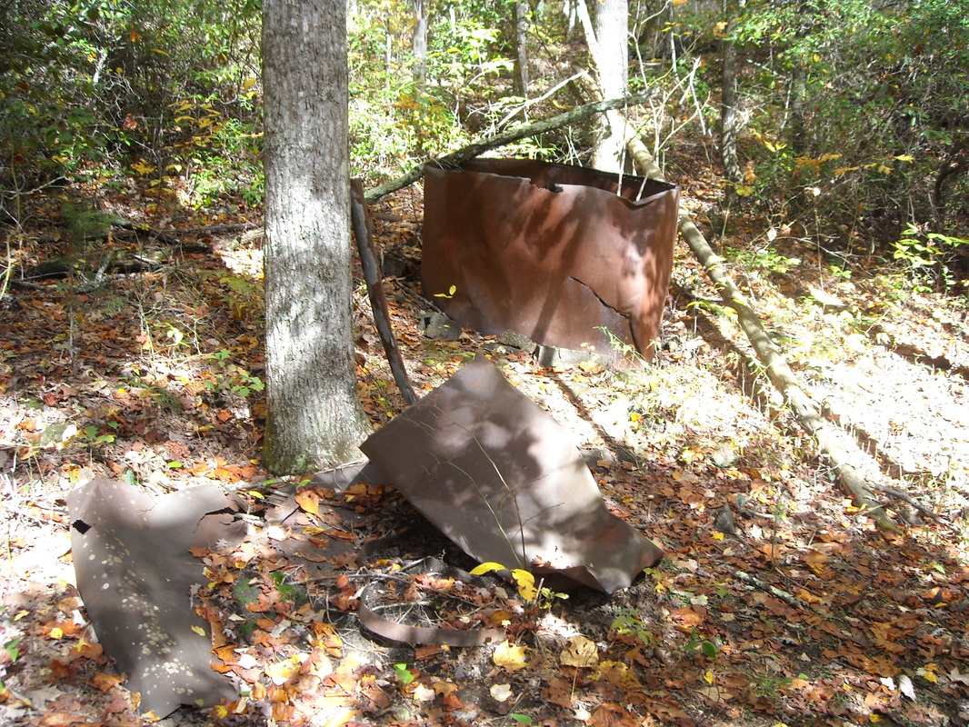
After a long hike, here is the approximate halfway point of Fiery Gizzard, an old ruined moonshine still, so busted that trees are growing through:
I retraced my steps from the still to the trailhead, but didn't take the same route. Instead of staying on Fiery Gizzard, I took the Dog Hole trail. Though you miss some of the creekside walking this way, Dog Hole stays longer at the top of the gorge, passing some great views. I actually got into a picture here, as I got lucky with the angle on my old digital camera:

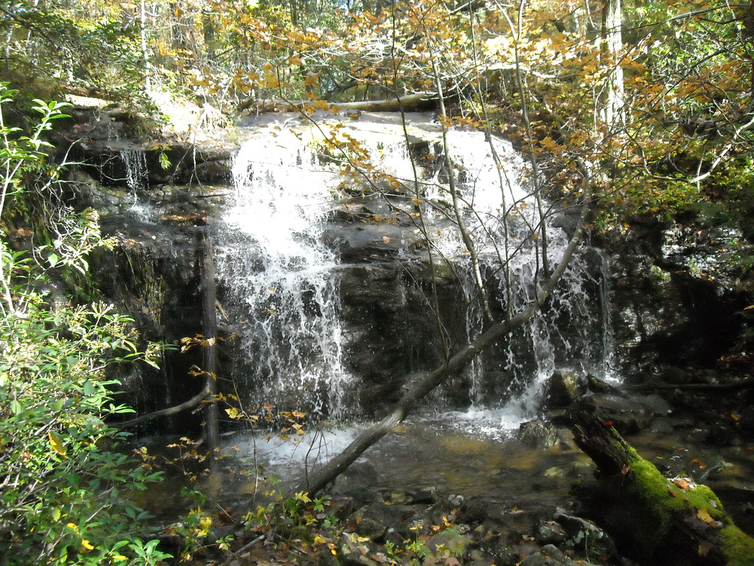
Here's another pleasant waterfall:
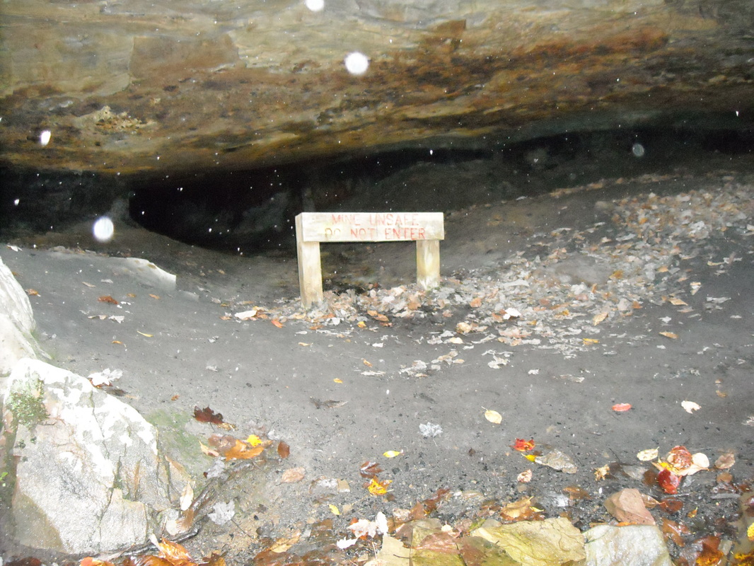
Near where the trail rejoins Fiery Gizzard, you pass the namesake: Dog Hole Mine, this dismal looking hole stretching back into a hillside. It looks tempting to explore, but that sign actually says "Mine unsafe. Do not enter." Probably best to believe it. You know how stupid I'd feel if I died because I went past a sign explicitly telling me it's unsafe to proceed?
Returning to the trailhead, I took the other way around the short Grundy Forest Loop to cover every bit of trail I could. This day I hiked, with the several side tracks, a total of about 15 miles, still one of my longest ever single day treks.
I drove into the little town of Monteagle and ate at a delicious local barbecue place called Joe Oliver's to replenish lots of calories, then found a motel.
The following day, I drove out to the Foster Falls trailhead to hike the other end of the trail. The beginning of this end of the trail is beautiful, overlooking Foster Falls itself and following the top of the gorge through cedar trees. After about 2.5 miles, the trail turns sharply to the left and descends steeply into Laurel Gorge. This turn is easy to miss, and I did in fact walk right past it. Gradually, the trail got thinner and thinner until it vanished completely. A couple had made the same mistake I had, and I retraced my steps back to the trail and was able to find the descent into the gorge. I then found the couple and kindly told them where the actual trail was! This is one of the nice waterfalls you have to walk across here:
One I managed to find the turnoff, I descended a steep, rocky, uneven path to a small bridge crossing Laurel Creek. The view from the bridge:
The trail then climbs just as steeply up the other side of the gorge. Then begins the least interesting part of Fiery Gizzard, as the trail gently winds through flat, repetitive forest for about 3 miles. There aren't any overlooks or challenges, just a hypnotic path. Eventually, I reached the still and turned back.
Once crossing Laurel Creek again, I kept my eyes open for the Climbers' Loop, an alternate path back to the trailhead. This trail descends a staircase from the main trail and follows the base of a cliff wall which is great for rock climbing. In fact, people were climbing as I walked by. The Climbers' Loop drops you off at the bottom of Foster Falls for a nice view of the falls:
Once crossing Laurel Creek again, I kept my eyes open for the Climbers' Loop, an alternate path back to the trailhead. This trail descends a staircase from the main trail and follows the base of a cliff wall which is great for rock climbing. In fact, people were climbing as I walked by. The Climbers' Loop drops you off at the bottom of Foster Falls for a nice view of the falls:

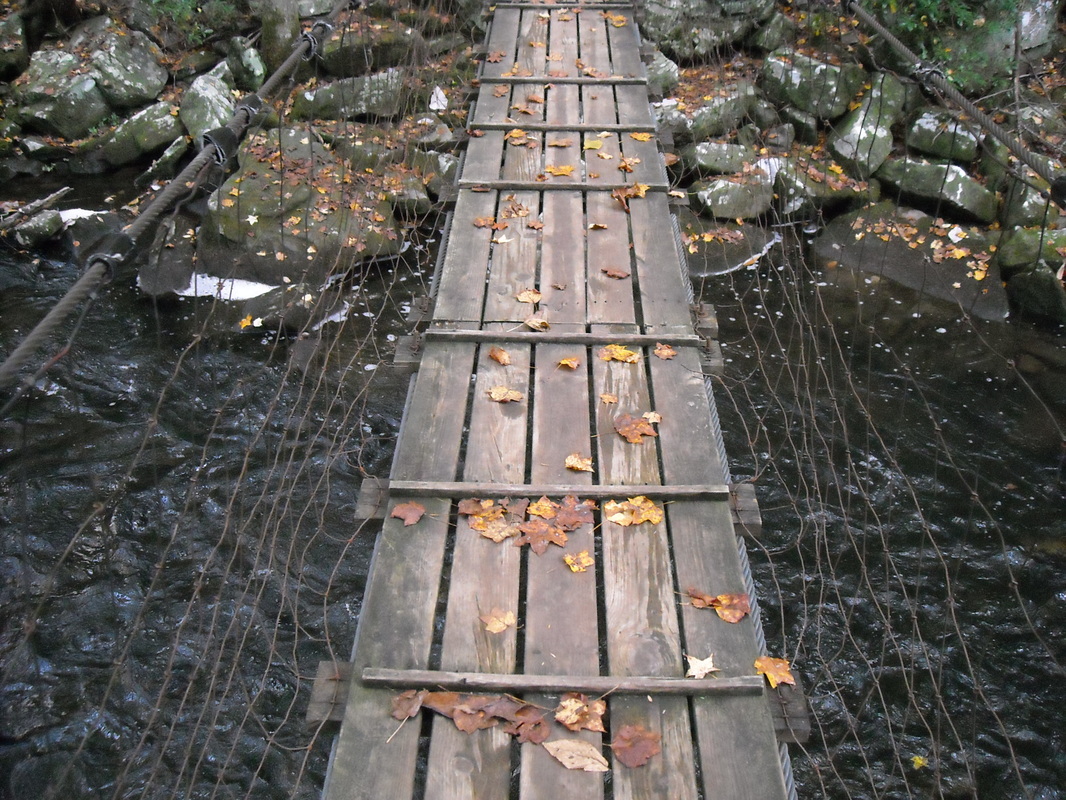
Cross this swinging bridge, climb a small rocky ascent, and you're back at the trailhead.
Fiery Gizzard is an exciting, varied hike and my first trail with double-distance mileage. What an experience! I would be on the lookout for more.