Far from any large city and relatively unknown, Theodore Roosevelt National Park - the only one named for a person! - is an incredible place to visit if you like solitude. The park is not crowded even in mid summer, the wildlife is abundant and not particularly fearful of people, and the vistas are striking in their rustic simplicity and beauty. Teddy Roosevelt himself owned ranch land in the area (in fact, two of his ranch cabins are preserved in the park) and often attributed his success as President of the US to the time he spent here. Roosevelt was legendarily tough. He was shot in the chest during an inauguration speech, calmly acknowledged that fact to the crowd, then finished his speech before going to the hospital. Can you imagine any president since doing that? Explore these expansive prairies and badlands, and perhaps you will become as tough as Teddy Roosevelt. (But probably not.)
Petrified Forest Loop
The first of two long day hikes I took in Theodore Roosevelt NP, Petrified Forest is a phenomenal experience. (The hike is listed at 10 or 16 miles depending on the source, but the loop I hiked was around 10 miles. There's no way it was as long as 16 miles, so I'm not where the extra 6 miles comes from.) I had to drive several miles up a gravel road to reach the trailhead, which is right on the park boundary. As I was assembling my backpack and putting on sunblock in the parking lot, a busload of high school kids pulled up and I ended up walking in their midst on the first part of the trail. The park is surrounded by a fence to keep ranch animals out and to keep the park’s wild buffalo herd in, so I had to enter the park through a gate to begin the trail. After about a half mile, the trail forks, and both ways lead to plenty of petrified wood soon after the fork. A hiker can see both sides of the petrified forest without taking the entire loop in about 3-4 total miles of hiking. The whole loop leads far beyond the petrified forest into the park’s backcountry, follows the Maah Daah Hey trail for about three miles, then returns. Maah Daah Hey is a long-distance trail (90+ miles or over 140, depending on the source) that connects the two units of Theodore Roosevelt NP. I turned left at the fork, meaning I’d see the north area of the petrified forest right away, and the south end on the way back.
The high school class had chosen the same path, and I caught up to them and was walking in their midst. Turns out they were a biology class from a small town I’d never heard of near Bismark. This was late June, so I suppose they must have been a summer class. The trail led through some unusual rock formations as we approached the badlands, including some strange rocks shaped like mushrooms, with narrow stems and wide, flat tops. The formations were as tall as people.
The high school class had chosen the same path, and I caught up to them and was walking in their midst. Turns out they were a biology class from a small town I’d never heard of near Bismark. This was late June, so I suppose they must have been a summer class. The trail led through some unusual rock formations as we approached the badlands, including some strange rocks shaped like mushrooms, with narrow stems and wide, flat tops. The formations were as tall as people.

In this strange landscape, we came across a buffalo, snoozing on a ledge overlooking the trail. The huge, majestic animal was quiet, and the class didn’t notice it until some of them had already walked by. It looks like I'm taking a picture of this girl but, in fact, I'm trying to get the resting buffalo. You can see its dark head on the ridge above and just to the left of her:
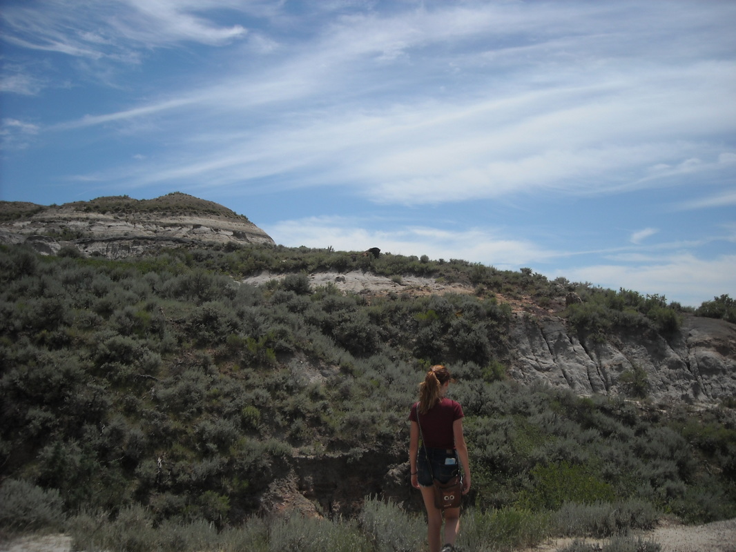
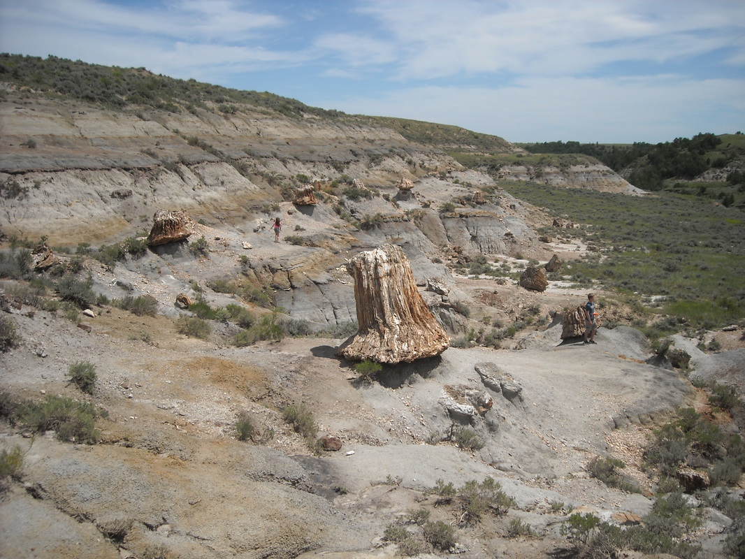
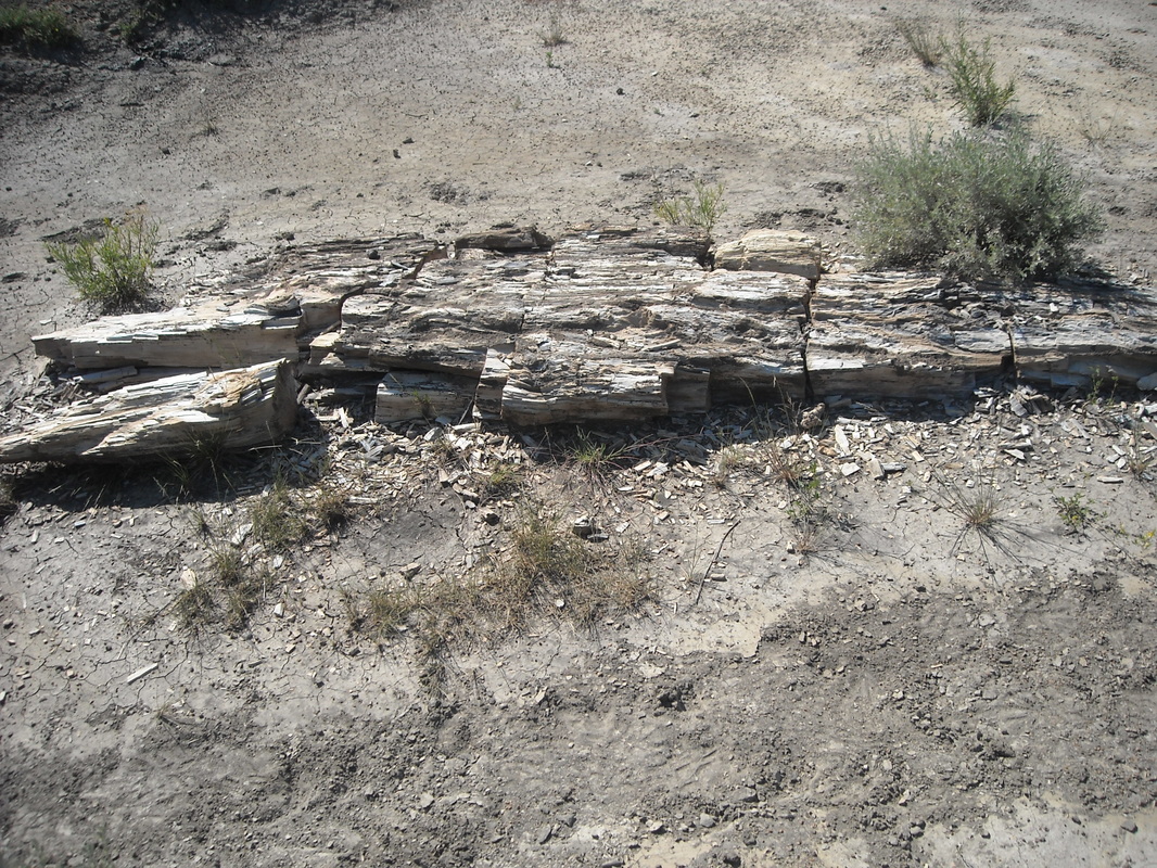
I was planning to walk off the trail to get around the huge animal (you’re told to stay 100+ yards away from buffaloes – they can be dangerous!), but the whole class stayed on the trail and the buffalo ignored them. The trail would be fine. Here we entered the petrified forest and admired huge trunks and logs of bizarre petrified wood. Seeing petrified wood up close isn’t something you can do every day, and this collection of it is actually the third largest in the US. It is also much less visited than the bigger ones, which are in Petrified Forest NP and in Yellowstone. It looks like oddly-colored wood, even close up where you can see all the texture, but is in fact stone. Look at the people in this shot for scale - this valley and its petrified wood are bigger than they look.
After exploring the forest, I continued along the trail up a ridge where I could look down on the petrified forest, the high school class, and the relaxing buffalo we’d just walked by. All of that was perhaps 200-250 yards away. From the top of the ridge, I saw one of the stupidest things I’ve ever witnessed. A few of the students were admiring the buffalo from a safe distance. One, however, decided to see how close he could get and slowly advanced on the animal. His classmates began hollering at him, telling him he was stupid and that he should turn back, but he didn’t. I guess, like many dumb people, he figured that being the center of attention was more important than anything else. I stopped where I was (any farther and I wouldn’t have been able to see them) and pulled out my phone, which somehow had reception, ready to call 911. Sure enough, the doofus approached within a few yards of the buffalo, who stood up turned straight toward the kid, stomping the ground angrily. The kid took off back to the trail and thankfully the buffalo didn’t charge. He was lucky.
Over the top of the ridge, the trail leveled out across a broad, grassy plateau. About 150 yards away, another buffalo stood right on the trail, not moving. A few hikers were waiting beyond it on the trail, hoping it would move. I decided not to wait, and instead simply walked off the trail and way around the buffalo. The flat area was plenty large to do this without coming close to the animal. However, a hiker who must have been not far behind me did the second incredibly stupid thing I’d seen in ten minutes. He ran straight at the buffalo, yelling and waving his arms. The buffalo, amazingly, didn’t gore him to death, but instead retreated far enough off the trail that we could walk through the trail. Yes, it worked this time, but PLEASE don't try this.
Past here, the trail is wonderfully serene as it winds through grassland across the plateau. You have wonderful views of the badlands over the sides of the flat hilltop:

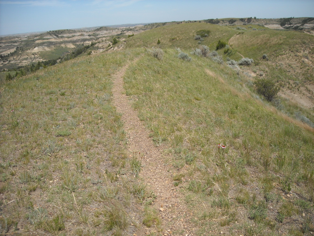
The plateau gives way to a narrow ridge, with the faint path curving invitingly through the grass. I love views like this. Where is this trail going to take me next?
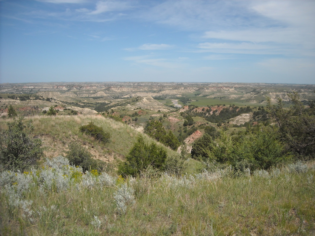
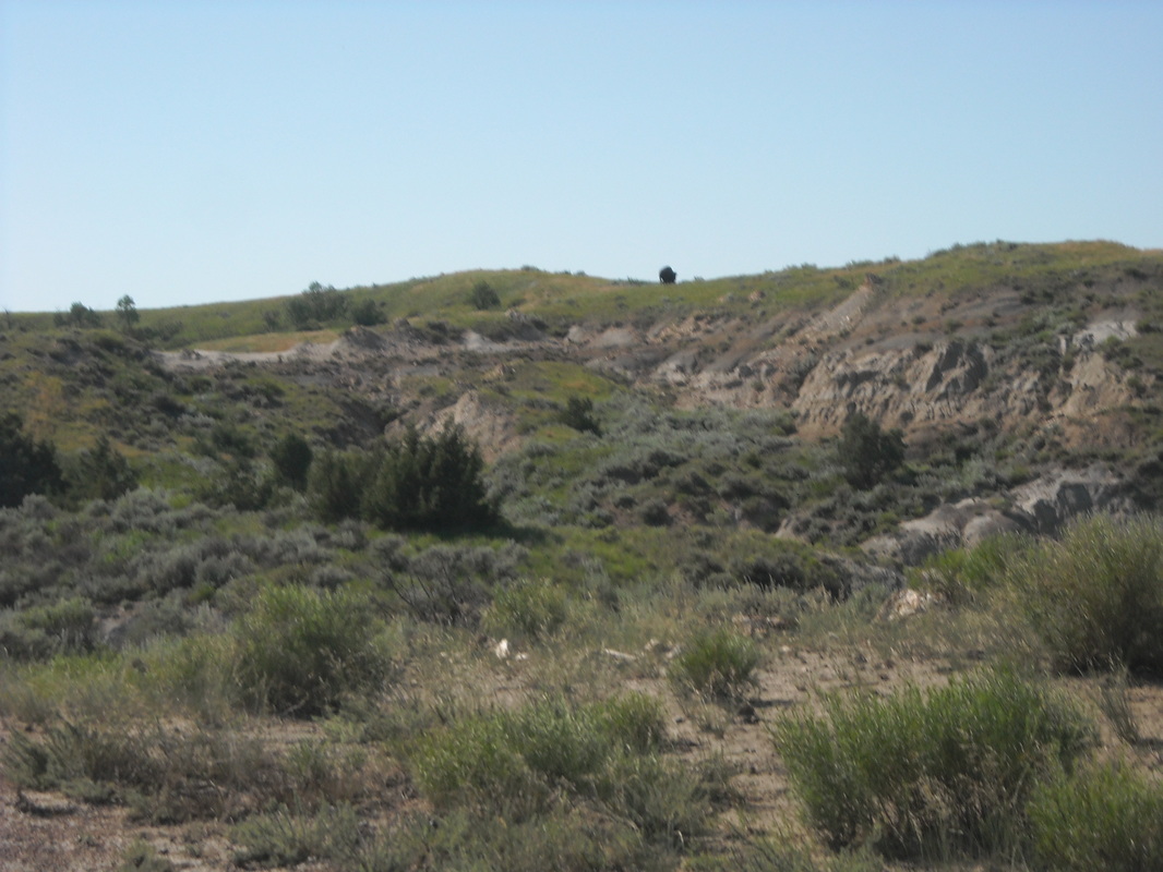
After traversing the gentle ridge, the trail descends into a stunningly beautiful valley full of small patches of trees, then up the back side of the valley, where it joins the Maah Daah Hey. The loop follows the Maah Daah Hey for about three miles of hypnotically flat, winding grasslands. All through this portion, you can see Theodore Roosevelt NP’s colorful, rustic badlands off to your left:
I felt like I was floating through this remote backcountry section of the trail. Another buffalo came into view, laying down in the field off to the right of the trail. Now that I was totally alone, I was a little nervous. I gave the animal a wide berth, walking way off the left side of the trail and behind a low ridge so I was out of its view. It ignored me. I came to the junction with the Petrified Forest Loop’s south fork, and turned back towards the trailhead. Here I passed another lone hiker coming from the other direction – the only person I saw in the backcountry area. Gradually, the flat grassland gave way to the strangely carved badlands of the petrified forest area.
After admiring more fossilized wood, a hiking couple coming the other direction warned me that there was a buffalo near the trail up ahead. Sure enough, over a rise, I saw the buffalo up on a ridge. It must have moved because it wasn’t close enough to the trail to be a concern, but it made a neat picture, grazing alone on the ridge. That's it, the dark blot near the center of the ridge:
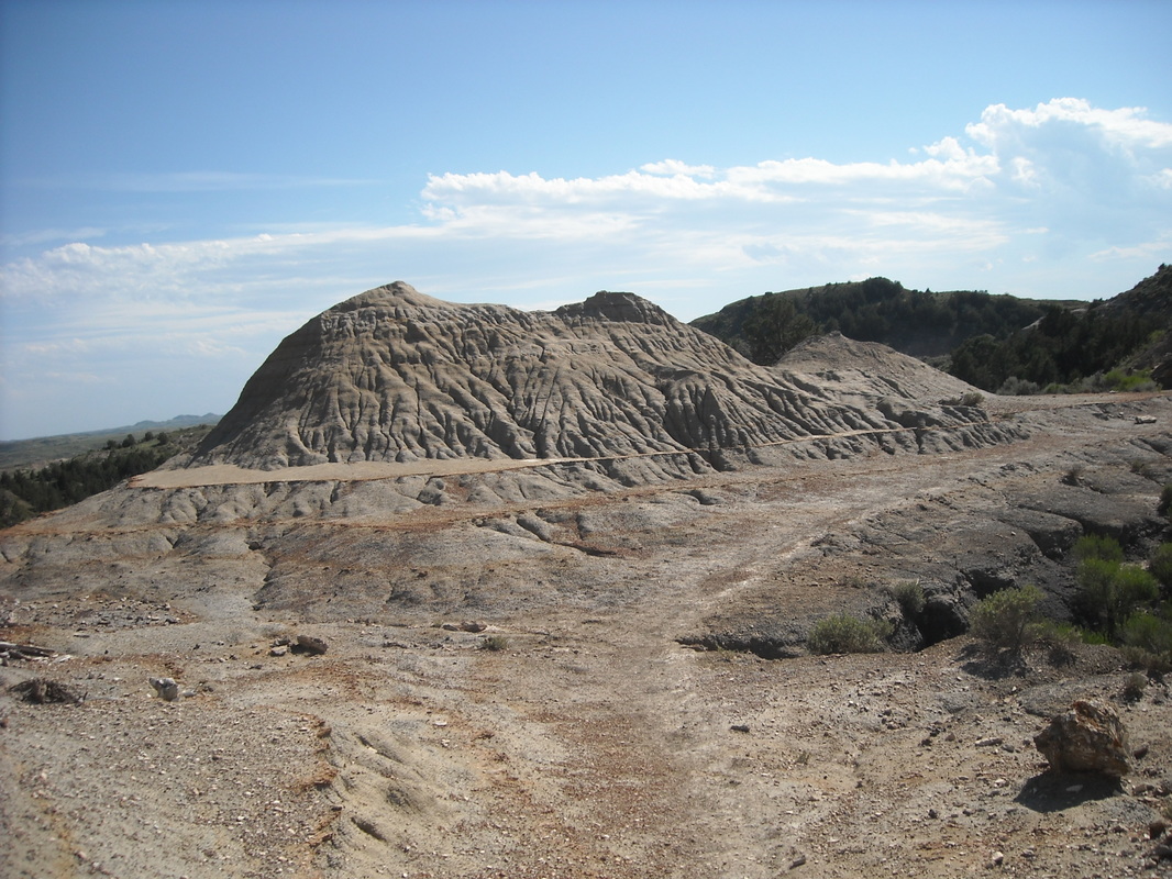
Here's another neat little badlands formation:
Before long, I was back at the trailhead. The Petrified Forest Loop is a long but rather easy hike otherwise, wonderfully, serenely relaxing. When I was there the trail was clear enough, but be cautious that Theodore Roosevelt's wilderness trails are marked by sporadic wood posts that may or may not all be there. They say the buffalo knock them over.
One of the things I enjoy about taking these trips, especially the ones like this that go way off the beaten path, is that I always seem to meet cool people and find interesting places to stay. This is Fran who runs the Diamond Bar B & B:
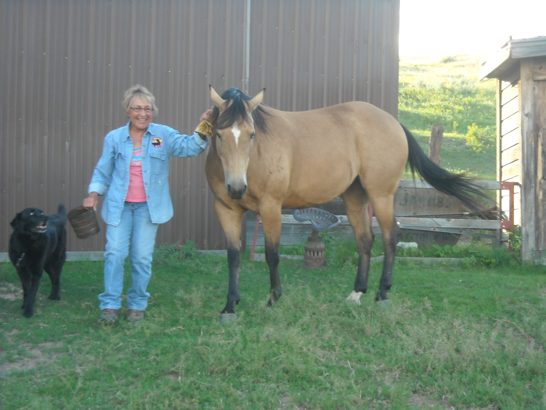
...Which is a cozy log house with beautiful horses and other animals on the property.
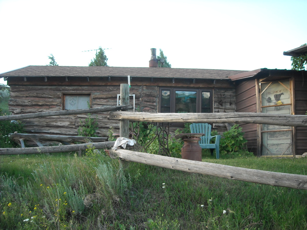
You can even stay in the barn (in a finished room)!
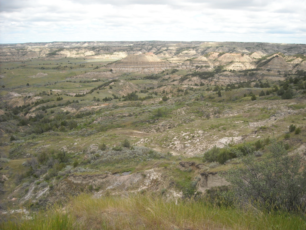
Painted Canyon
Between days with long hikes, I sometimes like to take a day to do some shorter hikes. On this trip, I took the Painted Canyon trail (4 miles roundtrip) and the Painted Canyon nature loop (1 mile). Both trails descend into the cozily quiet expanse of Painted Canyon, an area of green and red badlands.
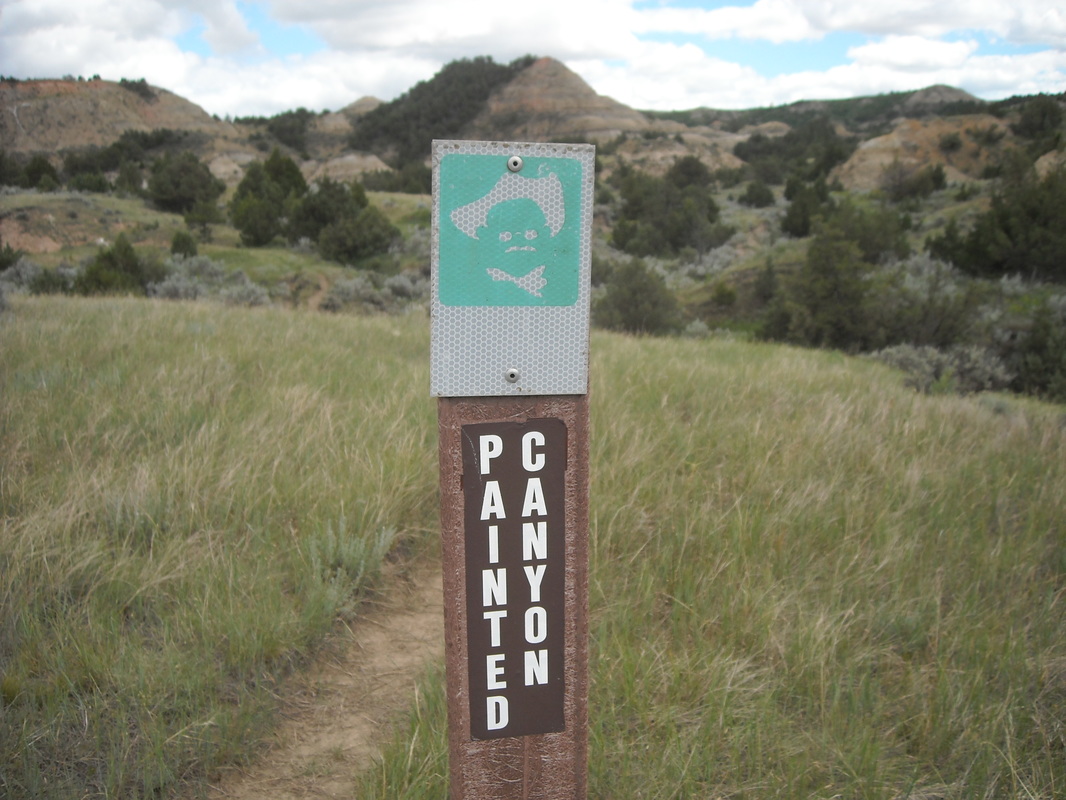
These trails are fantastic bang-for-your-buck trails: both are short and fairly easy, but lead you through amazing scenery. Painted Canyon trail is marked by these markers with a nice caricature of TR himself:
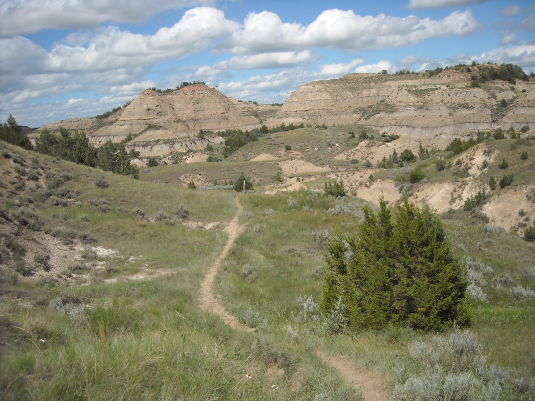
Doesn't this look like the setting for a fantasy novel? It barely looks real. What a neat place to explore.
One warning: The trailhead to the longer Painted Canyon route isn't very well marked. I turned onto the first trail that branched off the road, and it petered out after a quarter mile or so. Turns out it hadn't been a trail and the real start of the trail was a little further down the road.
Buckhorn Trail
Theodore Roosevelt NP is in two units, the south unit near Medora, ND and the smaller north unit an hour north near Watford City, ND. (There is also a tiny, difficult to reach unit in between preserving Roosevelt's Elkhorn Ranch.) I wanted to visit both units, so I headed north to Watford City so I could also hike in the north unit. Along the north unit's scenic drive, I came upon this herd of buffalo on the move (photographed from the safety of the car). Though I didn't manage to catch them in the picture, there were quite a few calves in the group!
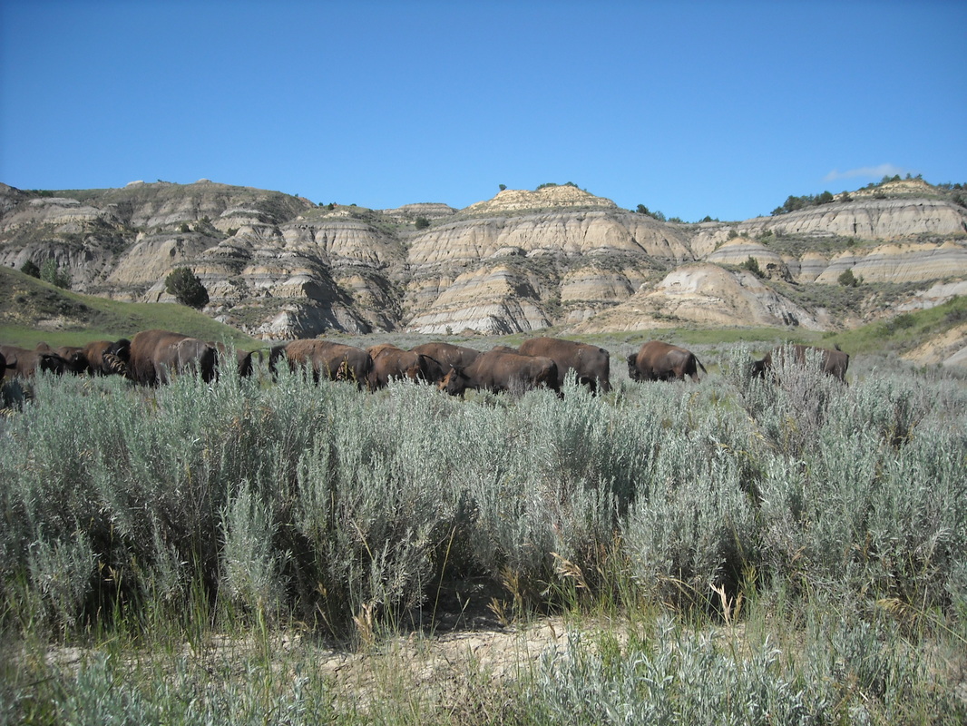
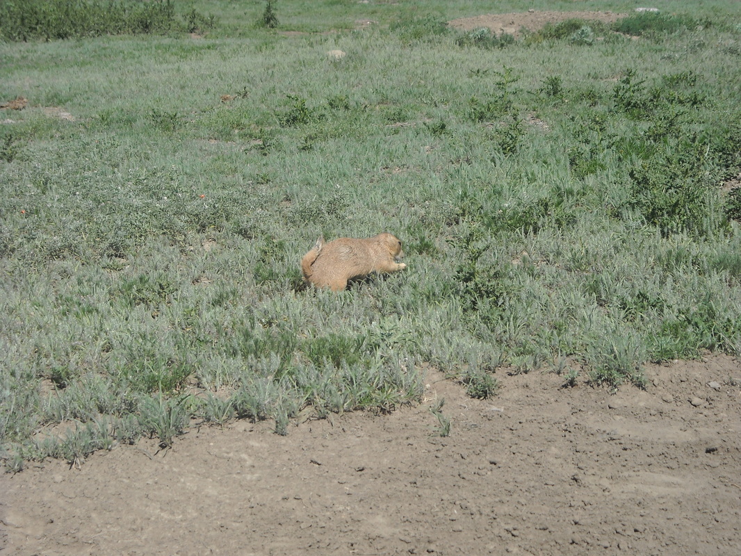
The Buckhorn Loop is a long trail, totaling about 12 miles, most of it in the remote wilderness of the north unit. This is the trail to take if you want to see wildlife! Besides the ever-present buffalo, there are several big prairie dog towns along this trail as well.
There are several places you can start this trail, since it crosses the road twice. You can start at the western side near Caprock Coulee or on the Eastern side of the trail. Starting at the campground is also a possibility. I started at the East trailhead and looped counter-clockwise. This way the first half of the hike was far off in the remote wilderness, while the second half would be close to the road. This was intentional - the wilderness trails tend to be hard to follow in this park. They're overgrown, faint in places, and follow infrequent wooden posts. By taking that section first, I could simply turn around if I lost the trail. The section near the road, on the other hand, I was less worried about, figuring I could just walk back on the scenic drive if necessary.
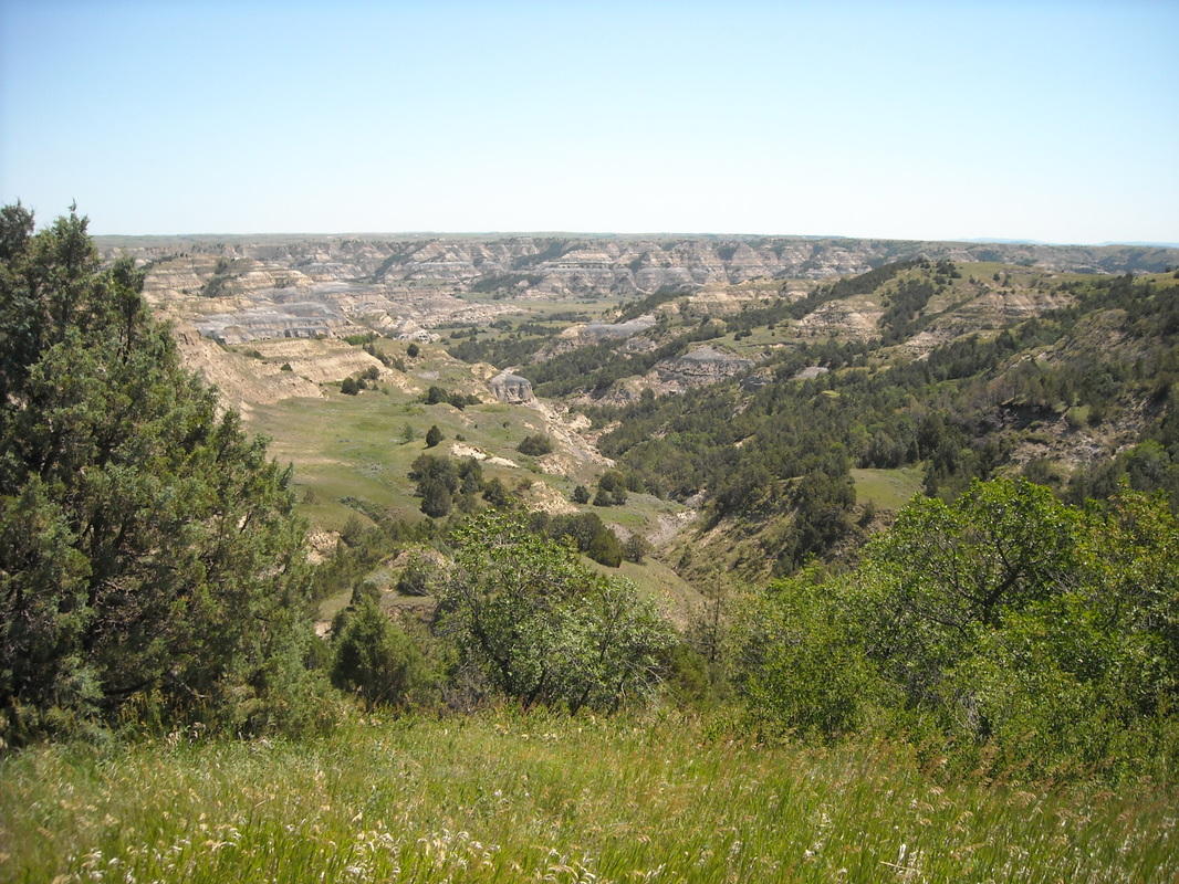
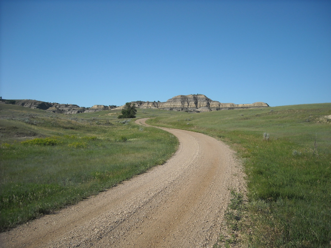
The beginning of the trail (at least, the beginning as I walked it) has a trail register (you may want to sign in - getting lost is not impossible!) and then wanders uphill around some badlands through dense woods and clearings of open prairie. Here, I came upon a resting mule deer who took off as I approached. The trail levels out onto a vast expanse of grassland and meanders across the prairie. Views from here are spectacular:
There are several places you can start this trail, since it crosses the road twice. You can start at the western side near Caprock Coulee or on the Eastern side of the trail. Starting at the campground is also a possibility. I started at the East trailhead and looped counter-clockwise. This way the first half of the hike was far off in the remote wilderness, while the second half would be close to the road. This was intentional - the wilderness trails tend to be hard to follow in this park. They're overgrown, faint in places, and follow infrequent wooden posts. By taking that section first, I could simply turn around if I lost the trail. The section near the road, on the other hand, I was less worried about, figuring I could just walk back on the scenic drive if necessary.
The beginning of the trail (at least, the beginning as I walked it) has a trail register (you may want to sign in - getting lost is not impossible!) and then wanders uphill around some badlands through dense woods and clearings of open prairie. Here, I came upon a resting mule deer who took off as I approached. The trail levels out onto a vast expanse of grassland and meanders across the prairie. Views from here are spectacular:
Don't try this hike without a map. It can be a little confusing. A few miles in, there is a four-way intersection. Left takes a short sidetrack into a prairie dog town; right a longer (nearly a mile) side track to a spring, and straight ahead continues on the main trail. Here's the spring:
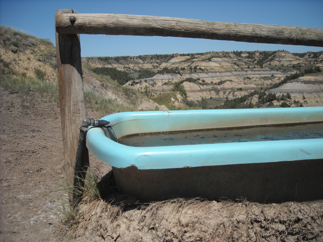
Water is flowing out of the spring into this tub. It looks nasty to me, but I suppose a horse could drink it.
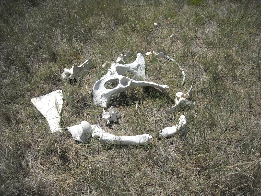
Along the broad, gently undulating path are scattered wooden posts to mark the trail. The faint trail isn't always obvious and you can't always see the next post from the previous one, so often you simply have to continue in the direction the trail was going and look for the next post once over the next rise. I always knew where the last post had been, but at one point I wandered off the trail and missed a post. Thankfully, I was able to spot the next one and get back on track. Around this point, I came upon this creature that didn't make it:
Along the broad, gently undulating path are scattered wooden posts to mark the trail. The faint trail isn't always obvious and you can't always see the next post from the previous one, so often you simply have to continue in the direction the trail was going and look for the next post once over the next rise. I always knew where the last post had been, but at one point I wandered off the trail and missed a post. Thankfully, I was able to spot the next one and get back on track. Around this point, I came upon this creature that didn't make it:
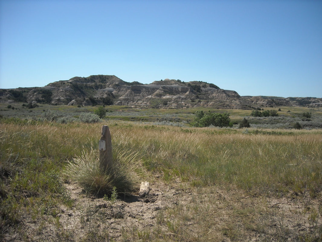
After the long traverse of the open grassland, the trail heads back into a dense forest and follows some dry washes before emerging back into a lower area of the prairie. Here's a trail marker as I'm approaching the western side of the loop:
The Western part of the trail passes two more prairie dog towns. They're not too shy of people in this remote park:
Here is where, for the first and only time on the northern part of this loop, I ran into a few people. It's not a long hike from the road to the prairie dog towns, so some folks just hike there. The path heads south and parallels the road for a while. Here is where I came across two buffaloes (at a distance), the only two I ran into on this hike. One was standing in a canyon at the base of the badlands, looking out as if he (she?) was on guard duty. The trail arrives at the Caprock Coulee trailhead, then crosses to the south side of the road, passes near the campground, and follows parallel to the road for the last few miles. This is the least scenic part, but I kind of like this shot of a service road that the trail crosses:
The trail follows near the scenic drive until it returns to the starting point. Don't forget to sign out on the register!
Buckhorn is another trail which is long, but not all that strenuous. It's a wonderfully relaxing experience as you share the park with its inhabitants!
Buckhorn is another trail which is long, but not all that strenuous. It's a wonderfully relaxing experience as you share the park with its inhabitants!